Categories
Papers Publications

New conference paper “Towards Geolocation of Millions of IP Addresses” at IMC 2012

The paper “Towards Geolocation of Millions of IP Addresses” was accepted by IMC 2012 in Boston, MA (available at http://www.isi.edu/~johnh/PAPERS/Hu12a.html).

From the abstract:

Previous measurement-based IP geolocation algorithms have focused on accuracy, studying a few targets with increasingly sophisticated algorithms taking measurements from tens of vantage points (VPs). In this paper, we study how to scale up existing measurement-based geolocation algorithms like Shortest Ping and CBG to cover the whole Internet. We show that with many vantage points, VP proximity to the target is the most important factor affecting accuracy. This observation suggests our new algorithm that selects the best few VPs for each target from many candidates. This approach addresses the main bottleneck to geolocation scalability: minimizing traffic into each target (and also out of each VP) while maintaining accuracy. Using this approach we have currently geolocated about 35% of the allocated, unicast, IPv4 address-space (about 85% of the addresses in the Internet that can be directly geolocated). We visualize our geolocation results on a web-based address-space browser.

Citation: Zi Hu and John Heidemann and Yuri Pradkin. Towards Geolocation of Millions of IP Addresses. In Proceedings of the ACM Internet Measurement Conference, p. to appear. Boston, MA, USA, ACM. 2012. <http://www.isi.edu/~johnh/PAPERS/Hu12a.html>
 

Categories
Announcements

IP Geolocation in our Browsable IPv4 Map

We’re happy to announce that our browsable Internet map at http://www.isi.edu/ant/address/browse/ now includes IP geolocation.

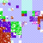
We plot the latitude and longitude of each IP address around the world as a specific color, placing them on our IPv4 map (the zoomable Hilbert curve).  Thus we can show how blocks of IPv4 addresses map (above) to the globe (below).

AMITE Geolocation of IPv4 as of 2012-06-28
Hue and lightness to longitude and latitude.

On the IP map, we show latitude/longitude by color.  For each address, the longitude is the hue (the colors around the rainbow), so North America is blue; South America, fuschia; Europe and Africa, red; and Asia to Australia yellow to green.  The latitude controls lightness, so things north of the equator are darker, while those south of the equator are lighter. Thus Japan is dark green, while Australia is teal, and Scandanavia is dark read, while south Africa is orange.  (We have released the source code to do this mapping with a BSD license.)

The IP map shows IP all 4 billion addresses on the Hilbert curve.  We have discussed this mapping before (see our poster).

Our IP map is zoomable and draggable, so one can look at particular regions of interest.  For example, here is 128/8, including ISI (in Los Angeles, dark blue), between UC San Diego (also dark blue) and University of Maryland (US east coast, so purple), while the Fininnish University of Helsinki is dark brown, and the Australian University of Melboure is lime green.

Annotated IPv4 geolocation

Our geolocation data comes from three sources:

All of these geolocation sources have varying levels of accuracy, however we hope that the ability to visually relate IP addresses (onthe Hilbert curve) with geolocation (via latitude and longitude as shownby color) provides a fresh look at IP addresses and their locations.

This geolocation work is due to Zi Hu, Yuri Pradkin, and John Heideman.  This work and visualization has been supported by the AMITE project through DHS, and the data (both processed geolocation results and raw data if you can improve our accuracy) will be available through the LANDER project’s datasets and the PREDICT program.


Categories
Publications Technical Report

New Tech Report “Towards Geolocation of Millions of IP Addresses”

We just published a new technical report “Towards Geolocation of Millions of IP Addresses”, available at ftp://ftp.isi.edu/isi-pubs/tr-680.pdf.

From the abstract:

Previous measurement-based IP geolocation algorithms have focused on accuracy, studying a few targets with increasingly sophisticated algorithms taking measurements from tens of vantage points (VPs). In this paper, we study how to scale up existing measurement-based geolocation algorithms like Shortest Ping and CBG to cover the whole Internet. We show that with many vantage points, VP proximity to the target is the most important factor affecting accuracy. This observation suggests our new algorithm that selects the best few VPs for each target from many candidates. This approach addresses the main bottleneck to geolocation scalability: minimizing traffic into each target (and also out of each VP) while maintaining accuracy. Using this approach we have currently geolocated about 24% of the allocated, unicast, IPv4 address-space (about 55% of the addresses in the Internet that can be directly geolocated).