ANT Outage World Map
About the ANT Outage World Map
The Outage World Map is an interactive website that allows one to browse multiple years of Internet IPv4 address space outage data collected by the Trinocular Internet Outage Detection System.
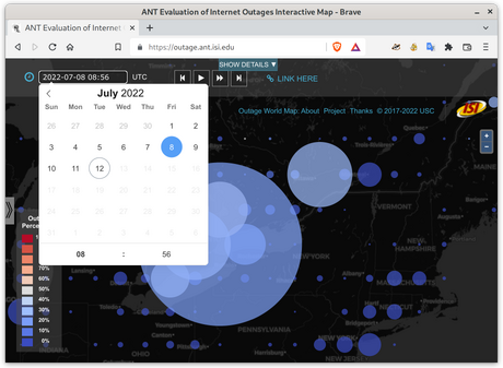
On this map, the world is divided into grid cells around some latitude and longitude. Circles show outages in each grid cell. Area shows how many networks (each an IPv4 /24) are out. Color shows what percent are out (scale at left).
On the map, you can:
-
select date time (top left)
-
play, step or pause (top center)
-
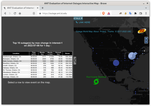
look for events (left side panel)
-
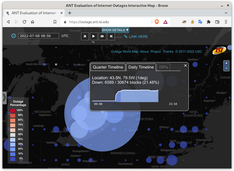
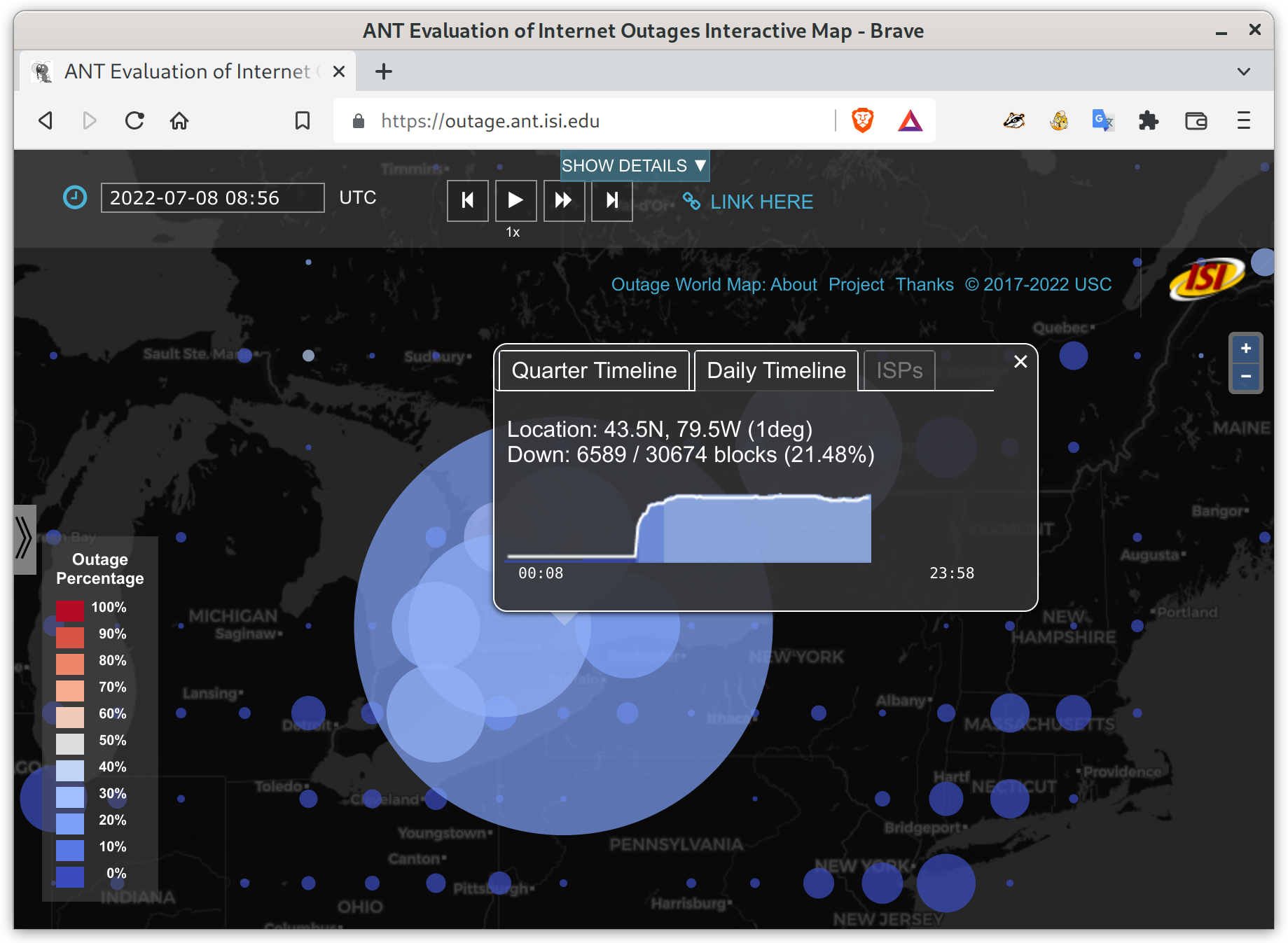
drill-down on details (click on a dot)


How Does It Work?
The map is driven by a near-real-time (NRT) version of Trinocular, our outage detection system. NRT Trinocular runs the core Trinocular detection algorithms on streaming data, typically reporting results to this website within about 60 minutes of data collection. NRT Trinocular has been in operation since September 2018 (and batch Trinocular since Oct. 2013).
For technical detail about Trinocular works, see our outage web page, the 2013 Trinocular paper at SIGCOMM, or the DUOI project or ANT Project publications pages.
Data Availability
Want to build on our work? We love to work with and share data with other researchers. See our outage dataset page, our general dataset page, and request details.
Thanks
Our outage detection work has supported by our research sponsors and pinger hosts, with open source code and data. We owe a huge thanks to all of them.
Current supporters:
- the National Science Foundation via award CNS-2007106 (EIEIO, to improve internet outage detection
Prior supporters:
- the National Science Foundation via award CNS-1806785 (IIOVADR, for visualization support in repsonse to hurricanes and natural disasters
- Department of Homeland Security (DHS) Science and Technology Directorate, Cyber Security Division (DHS S&T/CSD) via contract number 70RSAT18CB0000014 (DIOVICE, for algorithm development and validation
- Department of Homeland Security (DHS) Science and Technology Directorate, Cyber Security Division (DHS S&T/CSD) and the Air Force Research Laboratory via contract number FA8750-17-2-0280 (LACANIC, for census and outage data collection and sharing
- a 2017 Michael Keston Research Grant through a gift to USC, for website development
- Department of Homeland Security (DHS) Science and Technology Directorate, Cyber Security Division (DHS S&T/CSD) via contract number HHSP233201600010C (Retro-Future Bridge and Outages, for algorithm development and validation
- Department of Homeland Security (DHS) Science and Technology Directorate, Cyber Security Division (DHS S&T/CSD) via contract number NBCHC080035 (LACREND, for census and outage data collection and sharing
- Department of Homeland Security (DHS) Science and Technology Directorate, Cyber Security Division (DHS S&T/CSD) via contract number NBCHC040137 (LANDER, for census and outage data collection and sharing
Current pinger hosts:
- USC/ISI (both the Marina del Rey and Arlington locations),
- Colorado State University, the Network Security Lab
- Keio University and the WIDE project there
- the Athens University of Economics and Business
- SURFNet in the Netherlands
And current pinger recipients:
- nearly all of the IPv4 Internet that is willing to accept our pings
If your particular network is not in our outage system, then either someone has requested to opt-out, or you do not have enough ping-responsive hosts. You can check how many ping-responsive hosts we see by plugging your IPv4 address into the IP address box (in the top right) on our Internet IPv4 Address Browser.
(If your IPv6 address is not in our outage detection system: IPv6 outage detection is an open research problem. We’re working on it, but IPv6 is a lot bigger than IPv4.)
Copyright
All of our outage data and our Outage Worldmap Browser is Copyright © 2003–2023 by the Unversity of Southern California. (We do share outage data with researchers as described above.) The data is collected in the ANT Lab by Yuri Pradkin, with processing code by Pradkin, Quan, and Heidemann, with the help of our volunteer pinger hosts (listed above).
Our Outage World Map uses the SlippyMap from OpenStreetMap, with signficant custom modifications by Domink Staros.
The mapping data is Copyright © by the Open Street Map Contributors. It is licensed under the Open Data Commons Open Database License (ODbL), by the OpenStreetMap Foundation (OSMF).
The tiles in our Outage Worldmap use the Carto Dark (“Dark Matter”) and Carto Light (“Positron”) tilesets. These tilesets are by Carto, used under a CC-BY-3.0 license.